Wayfinder
Precision Rescue. Seamless Coordination.
Search and Rescue (SAR) professionals operate in high-pressure, life-or-death scenarios where every second counts.
A web-based mission management tool designed to consolidate and optimize mission workflows.
Built for civil, maritime, and aerial SAR teams, Wayfinder integrates real-time incident validation, resource allocation, and mission tracking into a single, operationally secure platform.
Leveraging live incident feeds, and structured workflow automation, Wayfinder reduces response times, enhances coordination, and ensures mission success under the most demanding conditions.
Engineered for Critical SAR Operations
Automated Data Validation: Filters false incident reports to ensure mission-critical focusGeospatial-Integrated Coordination: Synchronizes rescue operations and asset tracking
Interoperability: Seamless integration with military, government, and NGO SAR frameworks

Why Wayfinder?
Full Solution
Custom built workflows that accommodate start to end mission management
Increased efficiency
Reduce the time to validate incident beacons
Intuitive design
Easy to use workflows built for analysts to quickly see and report on alerts
Workload management
Balance workload at the individual and work center level
Automated Reporting
Gather SAR statistics and generate custom periodic reports automatically.
Wayfinder System Architecture & Core Capabilities
Built for the extreme demands of search and rescue, Wayfinder combines real-time geospatial intelligence, structured data workflows, and dynamic resource management in a single operational platform. From incident validation to asset deployment, every capability is purpose-built to reduce response time, enhance situational awareness, and improve mission outcomes. Wayfinder empowers SAR teams to act with speed, accuracy, and full visibility—when every second counts.
Incident Validation & Automated Reporting
Near Real-Time Geospatial Intelligence & Situational Awareness
SAR Asset & Resource Management
Incident Validation & Automated Reporting
Wayfinder leverages structured data workflows that enable SAR operators to:
- Ingest, categorize, and verify incident data from multiple sources, including distress signals, UAV reconnaissance, and human reports
- Implement real-time notifications for mission-critical event escalation
Technical Benefits:
- Save time, save lives by validating incidents as quickly as possible
- Improved mission readiness by enabling pre-deployment incident confirmation
Near Real-Time Geospatial Intelligence & Situational Awareness
Wayfinder provides live, map-based operational intelligence by integrating geospatial data with active mission workflows. The system enables:
- Multi-source sensor fusion combining EO/IR imagery, UAV telemetry, and terrain models
- Automated route optimization for search patterns based on environmental and mission constraints
Technical Benefits:
- Reduced search duration with predictive analytics-driven route planning
- Mission-wide visibility through live incident overlays and asset tracking
SAR Asset & Resource Management
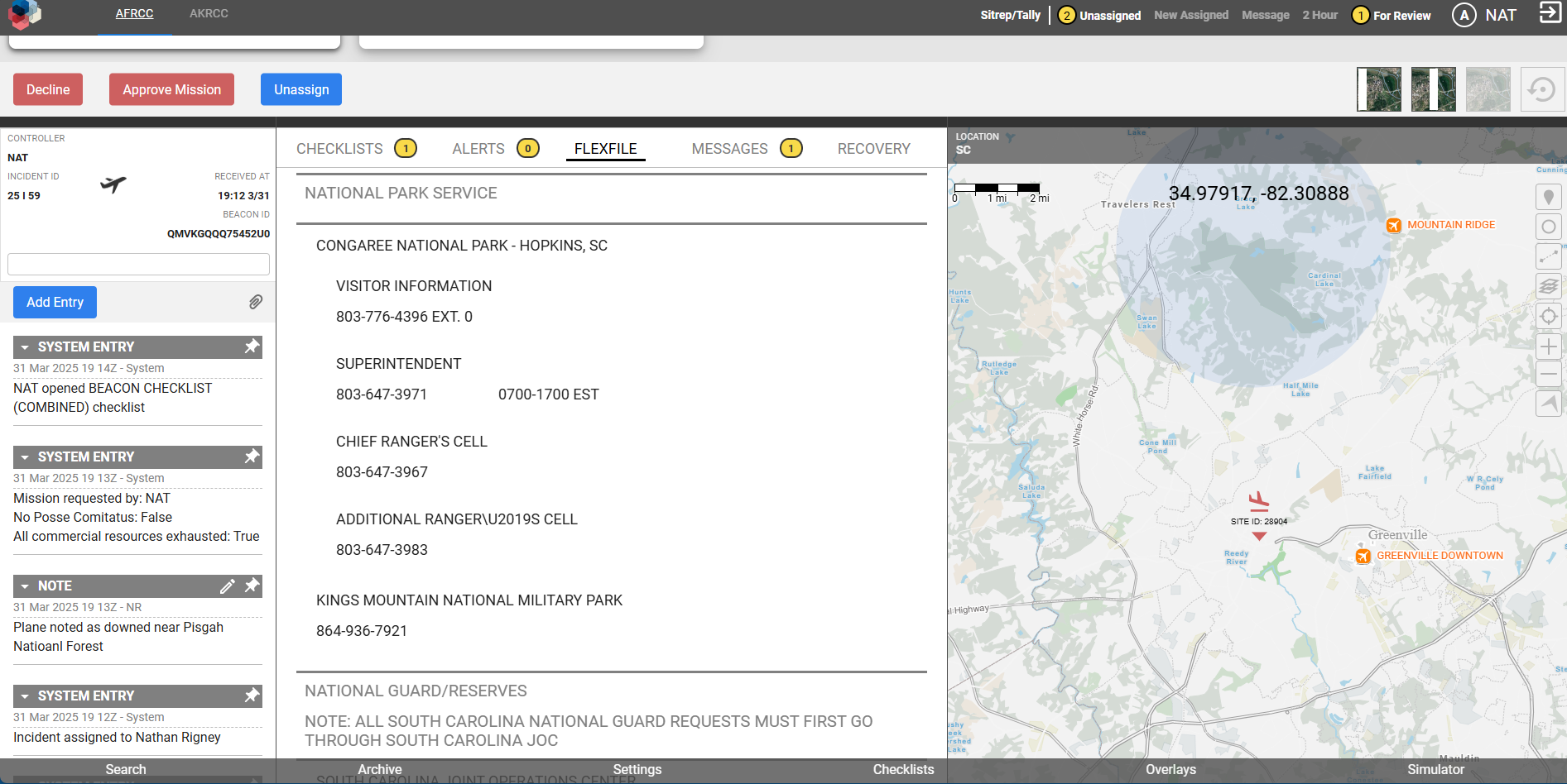
Wayfinder provides a single pane of glass interface for SAR mission controllers to:
- Track, assign, and monitor SAR resources in real time
- Optimize personnel deployment based on proximity, capability, and mission urgency
- Implement automated mission logging for post-action reviews and forensic analysis
Technical Benefits:
- Increased operational efficiency with automated personnel and asset allocation models
- Enhanced response coordination through real-time asset availability monitoring
- Improved compliance with automated data retention policies for mission logs
